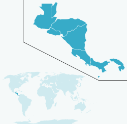
FERISTSA was the name of a proposed 1,600-mile (2,575.0 km) USD $3 billion privately-owned commercial railroad going from the Panama Canal Railway Company through the entire length of Central America, linking with Mexico's rail system at the Guatemala border, and thus to the United States of America.
Overview
Description
The railroad's main cargo would be containers to/from ports in Panama, El Salvador, Costa Rica and Guatemala. Currently, standard gauge track does not extend continuously south of Mexico and many of the existing narrow gauge lines to the south are abandoned, disconnected, derelict, or disused.
Planning
In December 2005, the Shaw Group announced that it was in talks with a number of large United States railroad companies to operate FERISTSA. At that time, the Shaw Group estimated that engineering feasibility studies would be ready in two years, arranging the project's financing, the bank syndication and the equity investment would take an additional year and construction of the project would take another four years, putting its initial completion around 2012.
The project is no longer mentioned on Shaw Group's website.
Route
The FERISTSA would run North-South from Mexico (and thus the United States) to Panama and beyond, and would complement Trans-Andean railways which go East-West.
Mexico
Guatemala
Honduras
Nicaragua
Costa Rica
Panama
(source:wikipedia)


No comments:
Post a Comment